


Georgian Bay water levels have hit record lows. Part of the problem is man-made and solvable! Mary Muter, chair of Sierra Club Ontario’s Great Lakes Section, explains what happened, why nothing has been done so far, and how we can fix it.
by Janet Lees ❧ photography by Richard Galloway
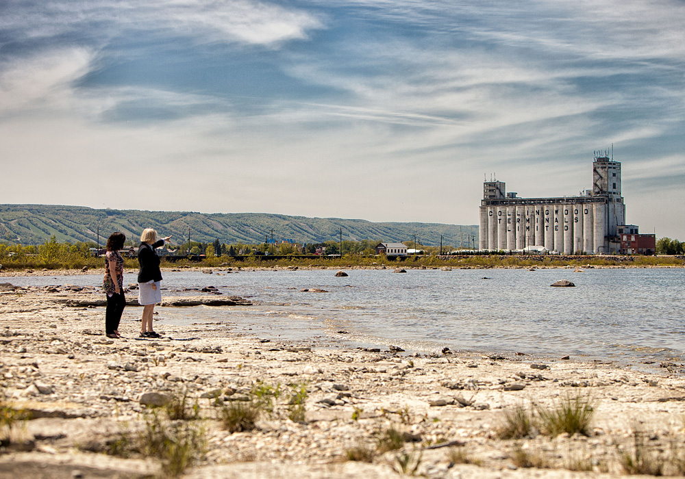
Click Image to Enlarge
 nown for years as The Georgian Baykeeper, Mary Muter has battled tirelessly to fix the man-made problem created by dredging the St. Clair River, which essentially ‘pulled the plug’ on Georgian Bay, creating a massive outflow. Internationally recognized today as an expert on the issue, and involved at the highest levels of the discussions, Muter is chair of the Sierra Club Ontario’s Great Lakes section, and vice chair of the newly formed Restore Our Water International. She is also the former vice president of the Georgian Bay Association.
arlier this year came the distressing news: the middle Great Lakes set a new record low for December and January and are in crisis, with Lake Michigan, Lake Huron and Georgian Bay losing 10 billion gallons of water per day due to dredging and erosion of the St Clair River. The results are evident: dried-up wetlands are decimating the recreational fishery; exposed shorelines are being taken over by a huge invasive reed, Phragmites australis; and pine trees are growing where fish once spawned. Our rapidly deteriorating ecosystem is causing die-offs of fish and waterfowl, massive algal blooms, stranded cottages, boathouses and docks, dry marinas, and ships carrying 25 per cent lighter loads.
Recently the International Joint Commission (IJC) recommended that the governments of Canada and the United States investigate structural options to restore water levels in Lake Michigan-Huron by 13 to 25 centimetres (about 5 to 10 inches), including a comprehensive cost-benefit analysis and a detailed environmental impact study.
Although future water levels are uncertain, we cannot ignore the damage from record low water levels, said Joe Comuzzi, Canadian chair of the IJC. From Georgian Bay to Door County, from shoreline property owners to the shipping industry, we heard calls for action, and we urge governments to act in response to our recommendations.
And something CAN be done, thanks to an outstanding Canada/U.S. agreement to place compensation sills or ‘speed bumps’ in the St. Clair River. The agreement was a condition of the dredging of the river for navigation in the 1930s and again in 1962, when the U.S. Army Corps of Engineers received authorization to install the sills. It turns out, that authorization was never withdrawn and could now finally move ahead. The Corps is now reviewing its St. Clair River flow data and depth profiles with a view to moving forward with an environmental impact study, cost benefit analysis, and ultimately, placing sills in the river to slow the outflow. More sills could follow, along with ‘gates’ and other measures to control the massive erosion in the river.
“We need a long term solution to this ongoing loss of water from these two important lakes,” said Roger Gauthier, a retired U.S. Army Corps of Engineers senior hydrologist who is chair of Restore Our Water International and a program director for the Great Lakes Commission. “It is time our governments acted to finally complete the terms of the outstanding bi-national agreement to install compensation structures in the St. Clair River to offset increased outflows caused by navigation dredging and sand mining in the river.”
Gauthier added the problem will not be solved until several U.S. government departments and the White House agree that the crisis is real and that the terms of the outstanding Canada-U.S. agreement on the St. Clair River now need to be met.
Since its inception in 2004, On The Bay has been raising the call for action to restore the water levels we lost through man-made interventions on the St. Clair. With the crisis worsening, there is finally some hope on the horizon as political attitudes appear to be undergoing a sea change. Last month, we sat down for a lengthy one-on-one interview with Mary Muter, the renowned Georgian Baykeeper who has fought for years – at times single-handedly – to keep this issue in the forefront. While she sees a light at the end of the tunnel, she warns that we must continue to be vigilant.
Q: Where do things stand right now?
A: The best way to describe it is that we right now have a two-goal lead. It sounds good, but hundreds of things could go wrong to take it off the rails. And that’s a result of the IJC’s recent advice to the government and now the U.S. Army Corps acknowledging that they have authorization to place compensation sills in the St. Clair River.
The IJC has rejected the recommendations regarding the St. Clair River provided by their Upper Lakes Study Board and instead has advised our government to examine structural means of reducing the conveyance capacity in the St. Clair River to restore Michigan-Huron levels by up to 10 inches or 25 centimetres. The U.S. Army Corp’s authorization that is outstanding was that compensation measures were to go in the St. Clair River as a condition of the 1962 dredging and they have authorization to restore by 7.1 inches.
Q: Assuming it’s possible to get somewhere in between those levels, and something can be done to restore 8 inches to our water levels, is that significant? Is it enough? Will it make a difference? Is it worth doing?
A: Yes it is significant, but you also need to realize that before they can do any of this, they’re going to have to figure out the sections of the river that are eroding, and cover over those areas with rock rubble. That alone will still stop this downward trend line that only Lakes Michigan-Huron have, and that might actually restore water levels a bit, too. We don’t know how much until they actually model that.
So, yes, it is a significant amount. It’s interesting, the IJC and our governments have acknowledged that we’ve lost almost 20 inches due to a combination of dredging and erosion – 16 inches due to the 1930s and earlier dredging and sand and gravel mining plus the 1962 dredging, and another four inches because of the erosion. As I said, 100 things could go wrong, and it’s only careful vigilance and coordination that will make sure it stays on track.
Q: These are all man-made changes that have caused a drop of 20 inches in Michigan-Huron water levels?
A: Yes, these are man-made changes that have increased the outflow through the St. Clair River. And when you’re asking if it’s significant, the U.S. Army Corps was summoned to appear before the U.S. State Department recently, and the State Department said, “What is this – the IJC is telling us we need to put structures in the St. Clair River; do you know anything about it?” The Corps said, “Of course we know about it,” and the State Department said, “We don’t know anything about this.” And the Corps said, “That’s because people don’t think of writing a letter to the State Department about water levels. But they sure know how to get hold of us – they send us letters and they phone us and tell us to do something about it.” So that’s the good news, but the Corps said to us, “You folks need to get down there.” So we are going to go down to Washington in the second week of June.
Q: Can you take us back to 1962 and help us understand why the St. Clair River was dredged?
A: For navigation. All of the connecting channels were dredged from 25 feet to 27 feet – two feet deeper – in order to let the larger ships through. And the governments knew they were permanently lowering the levels in Michigan-Huron, so the agreement between our countries for that dredging required that compensating sills go into the St. Clair River. And that agreement is outstanding; it’s never been withdrawn.
Q: So why did that never happen?
A: Because Canada bickered with the U.S. Army Corps for 10 years over the hydraulic impact of the sills they were going to put in. Canada was actually correct, but I read some correspondence where the Corps said, “Let’s go ahead and put these 17 sills in and see what the hydraulic impact is. If we need more, we’ll talk about that later.” But after 10 years of bickering the U.S. Congress withdrew the funding but not the authorization. So that agreement is outstanding.
Q: And the fact that the authorization was never withdrawn is something that was just discovered recently?
A: Relatively recently. I was aware of that agreement a long time ago, but I didn’t know that the authorization was still valid. Because it’s now 50 years old, the U.S. Army Corps sent it to their legal department in Detroit, it went to their regional office in Cincinnati, and it’s now with their headquarters in Washington.
Q: And there’s still an issue of who is going to fund it, correct?
A: Yes. There’s still an issue of funding it. But the Corps has certain pockets of money that they have used to date and they’re hoping to get another $3 million. They already took the symmetry depth measurements in the St. Clair River last summer. I believe that’s what’s driving them right now, that they know there is more erosion happening. And they have mentioned other funding and other work that they’re doing. They’re reviewing their St. Clair River flow data. So they’re doing a lot of the groundwork collection of data, so that they can proceed, and then they have to figure out what they need and mathematically model what they can do. So they’re getting ready to do that.
Q: What is the estimated cost?
A: They haven’t come up with a cost. When they were summoned before the State Department, in the room was a lawyer from our Department of Foreign Affairs. So obviously Canada is aware that this agreement is outstanding. “So the Corps was told to go back, figure out what you can do and how much it’s going to cost. And when you’ve done that, come back and tell us.” Our engineer has done some math based on the submerged sill design and has estimated the cost would be around $200 million. The Corps will probably push that number up higher than $200 million, but we’re not talking $2 billion.
Q: And the cost of not doing anything is substantial?
A: Yes, very substantial. You’ve seen the Mayors’ report on that? [Editor’s Note: Mayors of 24 Georgian Bay communities recently reported that lower water levels are affecting 68 marinas and 76 other businesses, as well as 31 government facilities, including municipal water systems, coast guard stations and the MS Chi-Cheemaun ferry. The report estimated cottagers will spend $500 million to extend and repair docks and water systems, and the negative impact on local economies is pegged at between $50 million to $100 million.]
If you consider the cost, even if it is $200 or $300 million, spread out over several years and shared by both countries, it is still much less than the cost of doing nothing.
Q: Is it looking, at this point, like the sills are still the option that is likely to move forward, or is it possible that the second option of gates will be put in place?
A: Maybe a combination of the two, but right now the Corps has authorization for the sills. So if they’re going to do anything different than that they have to figure out what process that would happen under. So I think what we’re saying is, let’s stick with the authorization they’ve got and then maybe have a phase 2, because we might need more sills. But let’s go for the 7.1 and later maybe do more to bring it up.
Q: What’s the cause of the erosion?
A: There are probably several factors. The dredging, yes, and in places removing the hard cover, but also, along the south shores of Lake Huron, particularly on the Canadian side, people have put in bedload traps or groynes, which are steel walls that go about 200 feet out. People put them in place and the sand accumulates up against these steel walls and then they use machines to remove the sand. So they have essentially removed the sand supply from flowing into the river, so it is a very turbulent, fast-flowing river. Those bedload traps were put in in the 1980s and 1990s. That sand acts as a slurry; when it mixes with the water it slows the flow, but it also settles to the bottom as it moves down the river. When you take that sand away, you’re exposing the riverbed to that fast flow.
The other thing is, at the outflow of Lake Huron into the St. Clair River, there used to be a natural sand and gravel bar that went all the way across it, which acted as a natural weir to the outflow. They mined it for sand and gravel a long time ago, to use for construction. So the weir was lowered, and then they cut through it for the navigation channel, at 20 feet, 22 feet, 25 feet and 27 feet. Basically they opened up the gates by doing that. So, it’s a combination of things. Our ability to understand these impacts is obviously much better. When they did the last dredging in ’62 they thought it was going to be a one-time drop. They didn’t realize that the riverbed was not stable and that it was going to erode. We uncovered that with the Baird report [a 2005 report by W.F. Baird and Associates Coastal Engineers Ltd. for the Georgian Bay Association].
No environmental impact study was ever done of removing the sand supply. There are two contractors who work to this day on a regular basis replacing the groynes as they wear out and hauling away the sand. And that’s just to keep people’s waterfront looking nice. No government agency was doing any monitoring in the St. Clair River, so nobody knew this was happening.
Q: Had there been remedial action back in the ’60s or ’70s, what would our water levels look like today?
A: They would not be where they are now. Absolutely not. If they had put those sills in, they would have then had to do some monitoring to figure out what the impact was of those sills. They would have had to put a flow meter in the St. Clair River. They didn’t even have a good flow meter in the river, so they didn’t know if the flow was increasing. And they would have had to be monitoring the flow to see what was happening over time. They would have figured out that it was eroding and they would have stopped the erosion. So, yes, our water levels would be significantly higher than they are right now; that’s for sure. I would guess between 10 and 20 inches higher, which would make a huge difference.
Q: Just how bad is the crisis today, and is there any reason to believe it will correct itself without intervention?
A: No. We’ve had a heavy spring rainfall/runoff event that has given us some temporary relief, but that’s all it is: a temporary relief. It’s only going to get worse. That downward trend line is going to continue. There are even deeper portions of the river now that are going to increase the outflow. We had double the average precipitation in April, and if that continues, it may give us some relief, but that is not likely to continue. Environment Canada is predicting a hot, dry summer again, so that could drop the levels right back down again. We set a new record low in December and January, and we were supposed to set it again in February. But I suspect that ice congesting in the St. Clair River may have given us some temporary relief again. But that’s not going to keep going on forever.
Q: What do you see as the permanent or major damage caused by the record low levels?
A: We’ve got a changing shoreline. We’ve got invasive species like phragmites taking over the exposed shoreline. We have now five- and six-foot-tall pine trees growing where there once were wetlands. We have a changing landscape, and it looks green so it doesn’t look to bad, but for the fish that used to get into those wetlands, that’s a big impact. People talk about dinged propellers and having to move their docks out, but the ecological impacts, in my opinion, are much more significant. We have an agreement with McMaster University and they’ve been tracking the changes over time in the wetland habitat. They have inserted tracking devices into pike and musky, and those fish are swimming many, many kilometers beyond their normal range trying to find wetlands they can get into. If they can’t find suitable spawning habitat, they simply don’t spawn. Right now we have congested wetlands because it shrunk the area and has remained at that same level for the past 14 years, so the plant community has become very dense and congested, and large fish simply can’t swim in and out of that narrow band of dense vegetation.
We need fluctuations, because that’s what allows the density to decrease and allows the wetlands to extend out and creates a diversity of plants. And that’s not happening. The rivers that fish need to get into to spawn – and there are less than 25 on Georgian Bay – but the Nottawasaga River, one of the main spawning rivers for lake sturgeon, walleye, trout and salmon, they can’t get in there so they can’t spawn. The extra rainfall might help a bit.
Q: If we don’t do anything are we just going to let the fish that can’t spawn not spawn forever?
A: McMaster has evidence because last summer they did seine netting to identify the young fish, and they found no young muskies. Some people say raising the water levels 10 inches/25 centimetres won’t make a difference. Well, water levels did come back up a bit in 2009/2010, and this spring when McMaster was working with MNR, they set trap nets and found trap nets full of three- and four-year-old Northern pike, and nothing any younger. So they know that in 2009/2010 with a bit higher water levels, pike were able to get in and spawn. And that’s why they’ve got a bumper crop of young pike and nothing since then. The average person looks out and sees their waterfront, but they don’t necessarily see what this means to the aquatic life. We think that’s the most significant impact.
Q: You’ve spoken about the ecological and environmental impacts. But there are also some pretty significant economic impacts, are there not?
A: Oh, yes, absolutely. Ships are light loading in the St. Mary’s River, and if it went low enough that they can’t move at all, that would have a huge impact on our economy. It’s impacting our economy now, but actually shutting down shipping would have a much more significant impact. Marinas are also being greatly impacted. Many of them are having to spend $30-50,000 to dredge. The sailboats have not been transiting up and down the east and north coasts for a number of years now. So we’re missing a lot of business that would normally travel these waters, which used to be some of the best cruising waters in the world. So that effects the local economies.
The impact on real estate is also significant. There was a hearing in Midland where the real estate agents spoke very eloquently about the impacts on real estate. And MPAC has now agreed that they will be reviewing the property value assessments for waterfront properties, but if waterfront property owners are paying less property tax, the rates for everyone are going to have to go up because they’re still going to have to collect the same amount of money. So even people who don’t have waterfront properties are going to be impacted.
Q: We’ve been talking about the impact of the St. Clair River outflow on our water levels. A lot has also been said about glacial shift and evaporation. What are the contributions of those factors to the declining water levels vs. the St. Clair River impact?
A: You’re comparing apples to oranges. According to the Baird Report we lost 23 centimetres between the mid-1980s and 2000, so in 15 years we lost 23 centimetres from outflow through the St. Clair River. The impact of glacial ice effect rebound in the worst case scenario, which is up in Northern Georgian Bay, is 25 centimetres per century. In other words, the earth’s surface is rebounding on the north side of Georgian Bay and lowering water levels up there by 25 centimetres per 100 years, but the changes to the St. Clair and the erosion is lowering all of the water levels on Lakes Michigan-Huron by 23 centimetres in 15 years.
Q: Global warming is another factor. How does that compare to the St. Clair River impact?
A: Climate is probably responsible for another 25 centimetres. Climate is definitely significant; you don’t want to ignore it. But it’s another issue, with different methods of dealing with it. It’s not either-or.
Q: Some people seem to be saying that climate change is the major issue and the St. Clair River impact is negligible compared to climate change. What do you say to those people?
A: To people who think that it’s mostly climate, we say yes, it’s part of the problem, and yes, we should be dealing with that. That’s a big-picture item that needs to be dealt with on a much broader scale. The IJC does not have reference from our governments asking them to provide advice on how to deal with greenhouse gases.
Q: What was the IJC’s original position on this?
A: Originally when we first started to look into this, we met with Environment Canada senior water levels staff three times, and every single time they patted us on the head and said, “We’re looking after this. You go away and mind your own business.” And the engineers just kept coming back to me with more and more information saying, “No, no, no this is serious; we can’t let this go.” So that’s when [the Georgian Bay Association] retained Baird and raised the $250,000 for that. And then we paid them to present their findings to the IJC. But the IJC chair, after a day-long presentation and discussion, said there was nothing that would convince him that there was a problem in the St. Clair River that required further investigation.
Q: Why was that the prevailing “official” position up to now? Was it political?
A: [Here Mary tells a long story, rife with intrigue and reminiscent of “deep throat” from Watergate fame, about meeting with a senior government advisor]. She said, “You and our organization have embarrassed our governments at the highest level.” I said, “Oh, really? I don’t think we intended to do that; we just wanted to bring light to this problem.” And she said, “Well, that’s what you have done and we can never accept these findings.” I asked why not and she said, “Because of the liability.” And I just about died. I said, “We don’t care about liability here, at all.” And she said, “Well, we do, and we have to. And the liability here could be huge for both our countries.”
Q: So, what has changed? Why do they now appear willing to do something to remedy the situation?
A: The only thing that I can think has changed is that over time they have finally accepted the fact that people are not going to sue them. And the U.S. Army Corps have been released from [previous] control, and have gone into the river and seen that it’s getting even deeper, and saying, “We have to act responsibly here.” And that’s all we want to happen. Also, the pressure from the public has had a huge impact. There were over 600 people last summer at the Midland meeting. The IJC normally would get 30 to 50 people at their meetings. That scared the daylights out of them. And I’m sure there were government officials at that meeting, too. And finally, it’s been going on for so long that the Americans have started to engage. Some of the groups were getting in touch with us and we realized we need to get Americans engaged. So we formed Restore Our Water International.
Q: Can you describe what Restore Our Water International is and why it’s important?
A: ROWI is a growing alliance of Canadian and American organizations concerned about the dire economic and ecological impacts of the low water crisis on Lakes Michigan and Huron, and Georgian Bay. ROWI represents at least 15,000 shoreline owners and commercial interests across these water bodies.
ROWI’s member groups include Sierra Club Ontario, Federation of Tiny Township Shoreline Associations, Three Lakes Association, Township Neighbours Network, and the U.S.-based groups Save Our Shoreline, The Great Lakes Coalition, Les Cheneaux Watershed, and Lake Charlevoix Association. We’ve met face-to-face twice now and we’re having monthly conference calls. Save Our Shoreline is engaging very aggressively with U.S. political leaders and we’re about to bring in another U.S.-based organization called the Great Lakes Coalition, which has 30,000 members. The U.S. support is what needs to happen, because the Americans are the ones who will end up making the decisions here. Canada will just go along, unfortunately. This isn’t going to happen without the Americans engaging, but they are starting to engage, and that’s very positive.
Q: What will be the process, and how will the two countries figure out how to make it happen?
A: That’s a big question. The IJC has now advised our governments to look at structural changes in the St. Clair River to restore Michigan-Huron levels by up to 10 inches or 25 centimetres. The U.S. Army Corps, on the other hand, have authorization, based on the outstanding agreement between our countries to place compensating measures in the St. Clair River to restore Michigan-Huron levels by 7.1 inches. So, now, somehow or other our governments have to come together to respect that agreement, and to figure out what is the right amount at this time to restore our water levels.
We think it’s going to have to be a two-phase project, and the initial designs will have to include additional measures that would not yet be approved or funded, but the initial phase would restore the 7.1 inches, and a subsequent phase would be able to do more than that. In order to get money for a phase 2, the Water Resources Development Act is right now being argued in Congress in Washington. That is the only vehicle that you could put money into a budget in 2015 for a phase 2. It passed through the Senate without that language in it, but we have gotten to some senators who are amenable to adding that language. Now we need to get the House to include it in their version and then the House and Senate need to come together and agree on it.
Q: You had mentioned earlier that the types of structures that are already approved in the 1962 agreement might have to be changed in terms of how they go across the river.
A: That’s correct, because the riverbed has changed over that time period. It is now scoured out and there are deep holes right adjacent to more shallow areas, so they will have to redesign. But we do not want the Army Corps to turn this into a 20-year project. The Army Corps loves to create studies that they work on for years, so it’s going to take a fair bit of effort to keep things focused and moving forward.
Q: The IJC’s U.S. section chair, Lana Pollock, did not sign the IJC’s recommendations to the Canadian and U.S. governments regarding what to do about water levels. In a note dissenting from the decision, she said the majority-supported recommendation would raise false hopes that the water level crisis, which is fundamentally a problem of climate change, could be solved by addressing a problem created in the ’60s. How strong a position does she have in this, and why is she taking her global view on worrying about climate change and greenhouse gases?
A: In my view it’s kind of like a Supreme Court decision where you have a dissenting judge, but the majority have come to an agreement on a ruling. So she basically has a minority position, but some media love to hear what that view is so she right now is getting a fair bit of attention, and undue attention in my opinion. She is the only dissenting opinion at this point.
Q: And her dissent is based on her belief that climate change should be focused on moreso than finding a man-made solution to the man-made problem in the St. Clair River?
A: Yes, and she is going well beyond the reach, the reference that the commissioners have from our governments, wanting to advise them what needs to be done about greenhouse gases rather than dealing with the St. Clair River, which is where the focus should be. The consensus is that structural changes need to be made to the St. Clair River to be able to restore Michigan-Huron levels.
Q: What is your feeling on timing? Based on the momentum that seems to be building now, are you hopeful that in the next year or two, something actually will begin happening?
A: I think so, if we can keep the pressure on – that has to be a given here, and it’s not easy – the work the Corps is already engaging in to collect the data they need to understand what’s happening in the St. Clair River right now, and if they can identify the areas that are eroding, then I would think that, everything being ideal, that next summer they could start to cover over the eroding areas, and the following summer be in a position to recommend what kind and how many and what size of submerged sills need to go into the St. Clair River.
Q: That sounds optimistic.
A: I am very optimistic, or I wouldn’t have kept at this for so long. Again, we have to keep the momentum going and we can’t afford to sit back and wait for something to happen. The women of the First Nations are now organizing a walk around Georgian Bay on June 21 – and we’ll be joining them – to express their concern about low water levels on Georgian Bay. That’s huge, and the politicians will have to sit up and take notice. On the U.S. side, their tribal nations have a right under their treaty to maintain fish habitat, and if their bottom lands are exposed it threatens their access to fishery, so they’re starting to engage on the U.S. side, too.
We have to stay on this. People are saying, “isn’t this wonderful news?” It’s great news, but we could still lose the whole thing if we don’t stay on it. However, if people continue to get involved, and stay involved, and make their voices heard in protests and at public meetings and in letters to their elected officials, we CAN make it happen!