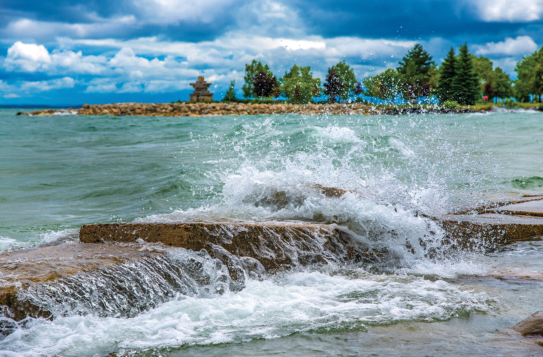
Georgian Bay’s water level is at an all-time high, leaving waterfront property owners and municipalities scrambling to mitigate damage and hold back the water and debris. What’s causing the rising water and what can we do to hold back the flood?
by Marc Huminilowycz, photography by Doug Burlock
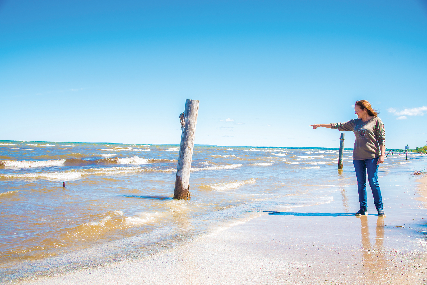
Lisa Mantella stands at the edge of her Wasaga Beach property on a sweltering July day and points to the water where, about 20 feet from shore, an iron bar protrudes from the gentle waves. “That’s my property line,” she says. “I used to have four posts on the beach marking the boundary between my property and the public Provincial Park beach, but they’ve all been washed up over the years. You can see two different colours of the water. The second colour way out there is where the beachfront used to be in 2011.”
Waterfront property owners like Mantella, as well as regional municipalities, Georgian Bay protection groups, and cross-border U.S./Canada Great Lakes agencies are all very concerned about rising water levels in Lakes Michigan and Huron (including Georgian Bay) which, this year, have set all-time high records. It’s a far cry from only a few years ago, when they were lamenting the opposite problem – record low water levels that exposed vegetation, rocks and debris along the shoreline and left some private docks high and dry (but on the plus side, greatly expanded local beaches).
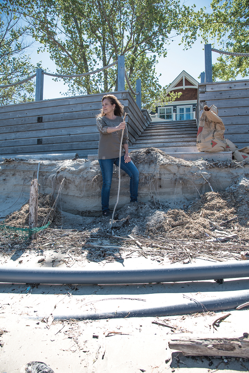
“Old fences from the 1950s, when the beach was more level, have been exposed, and the water has washed all the sand away,” says Mantella, whose family began vacationing in Wasaga Beach around the time those mid-century fences were built. “The third property to the east of us has a sand dune that’s at least 10 feet higher than the shore. That dune used to go out all the way to where the posts are in the water. There were 10 to 12 beautiful poplar trees on it, but they all got washed away.”
Mantella recalls when she and her family were able to walk up and down the beach – an activity that is now impossible, with only a few metres or less separating cottage properties and the water. She points to an old motel (now a condominium) a short distance away, with balconies precariously perched directly over the water. “On weekends, we get people coming from the public park nearby and setting themselves up for the day directly in front of our deck so that we can’t even access the water,” she says. “They may not know it, but they’re sitting on our property. Some of them get funny, arguing that this is public beach. We’ll probably put up some signage soon, telling people nicely that it’s private.”
Asked what she thinks will happen to the beach in the future, Mantella replies, “I’ve been up here since the 1950s. I think in a couple of years, the water will go down and the sand will come back.”
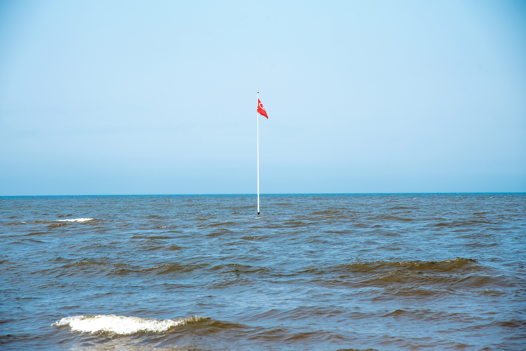
At the eastern end of Wasaga Beach, where the Nottawasaga River flows into the Bay, stands a flagpole in the middle of the water with a flag that reads, ‘No Swimming.’
“That flagpole is on a sand bar that, two years ago, was above water, separating the Bay from the mouth of the river,” says John Dick, owner of a waterfront home at the river’s mouth. “Cars used to be able to drive right up to the end of it and park. Now, it’s all under water.” Dick’s father-in-law bought the property, which originally contained a house, a small cottage and a vacant lot, in the early 1970s. He was the first among his neighbours to install a steel breakwall along the shore to prevent erosion.

In October of 2019, the situation became more serious, when an intense storm that picked up sand buried a good part of Dick’s and his neighbours’ properties all the way to the road.
“This was the mouth of the river right here,” says Dick, pointing to the edge of the breakwall. “The sand bar across the water grew and became covered in vegetation. Then, when the water was low, the river changed course and the mouth moved. Around 1992, the river came in and started taking away everybody’s properties, so other neighbours built breakwalls, too.”
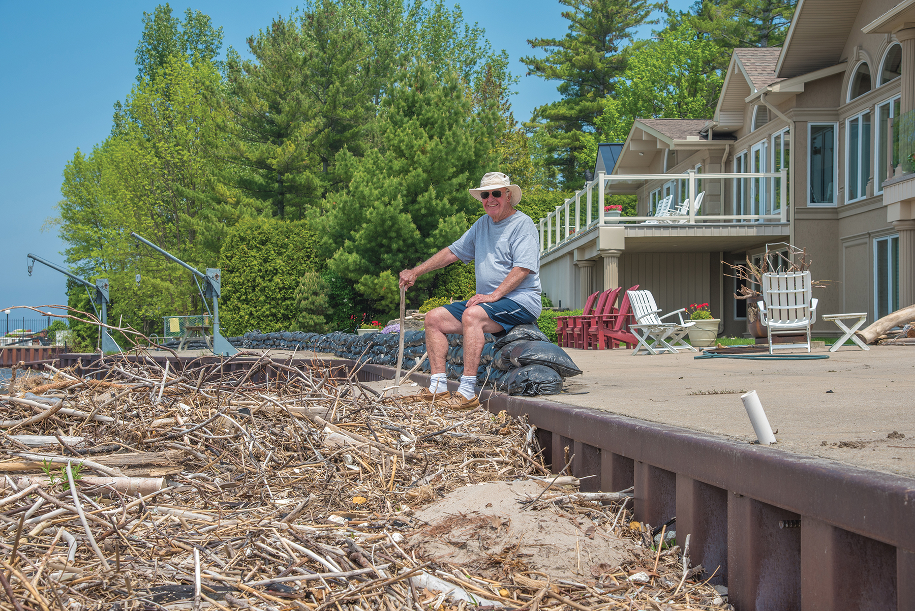
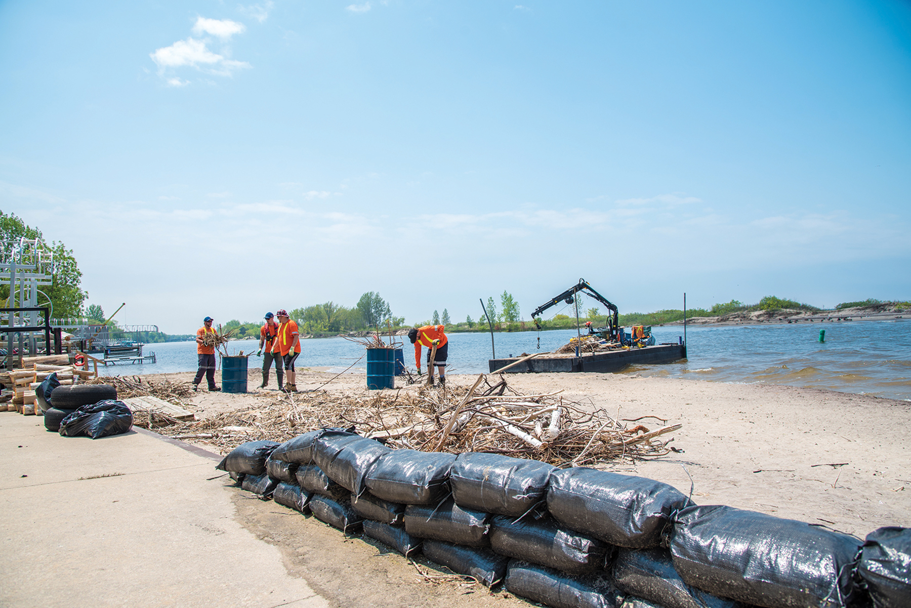
About two years afterwards, Dick recalls the course of the river changing again. “The water was so low here that the weeds came in, and it was good fishing,” he says. “Then last year, the sand began changing. It buried our neighbour’s breakwall, and waves brought in a lot of trees and trash that washed up on our shore. Thankfully, the town came in with a barge and cleaned things up. Everybody was laughing, saying we now had beachfront, not riverfront.”
In October of 2019, the situation became more serious, when an intense storm that picked up sand buried a good part of Dick’s and his neighbours’ properties all the way to the road. “I needed help to remove the sand, so I bought 400 sandbags, had them filled and piled along the edge of our breakwall. Last spring, the sand shifted again. People down the road from us lost everything. They had a breakwall, but the water undermined it because the steel wasn’t set in deep enough.”
The sand is burying boat launches and, by next year, Dick predicts that the sand bar across the water will be completely gone. “It’s all due to high water in the lake – nothing to do with the river. The Nottawasaga Valley Conservation Authority won’t let anyone put in steel breakwalls like ours anymore – only square stones or cedar posts. Right now my break wall is about four feet above the water. If I ever needed to raise it, I’d have to do stone. This is serious. My fear is that people aren’t paying attention.”
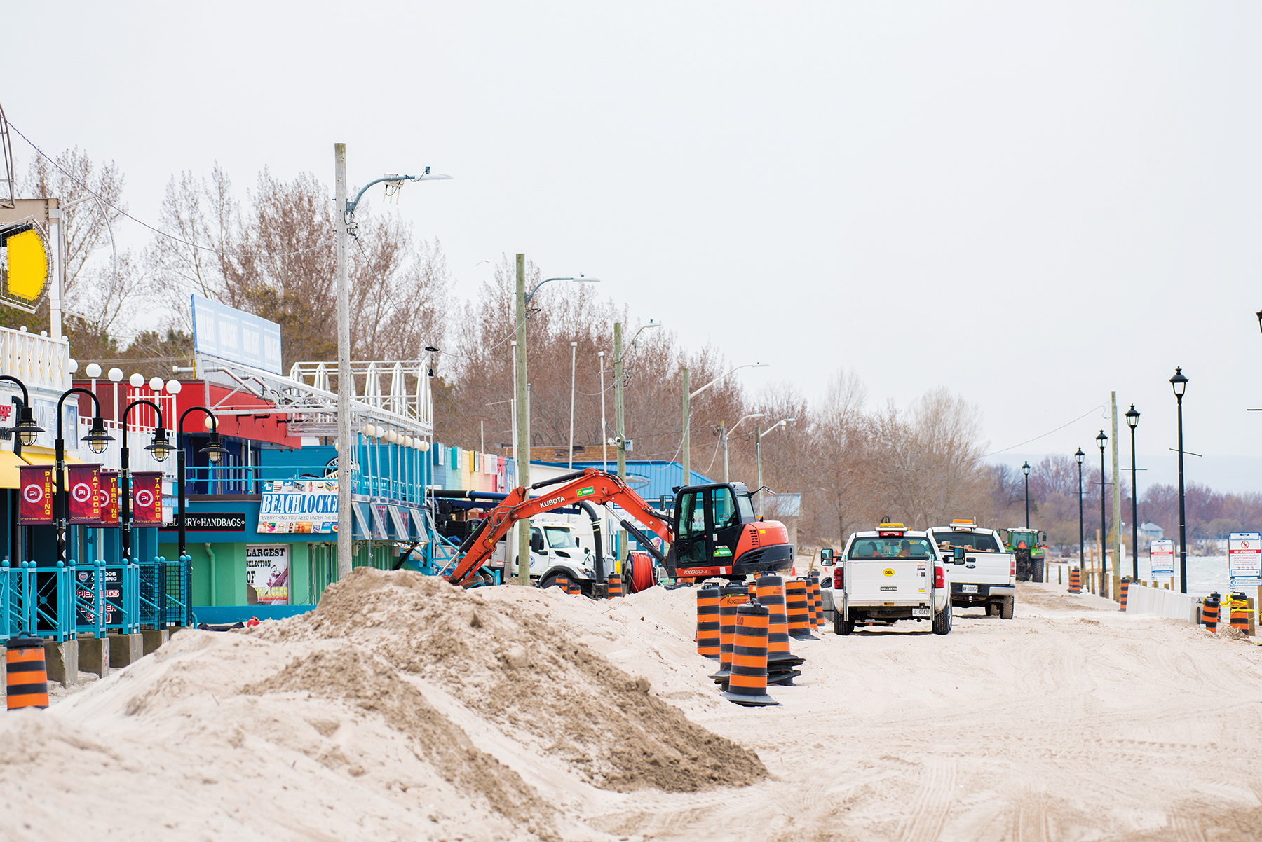
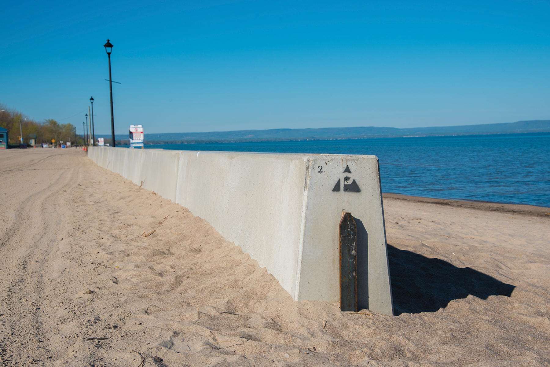
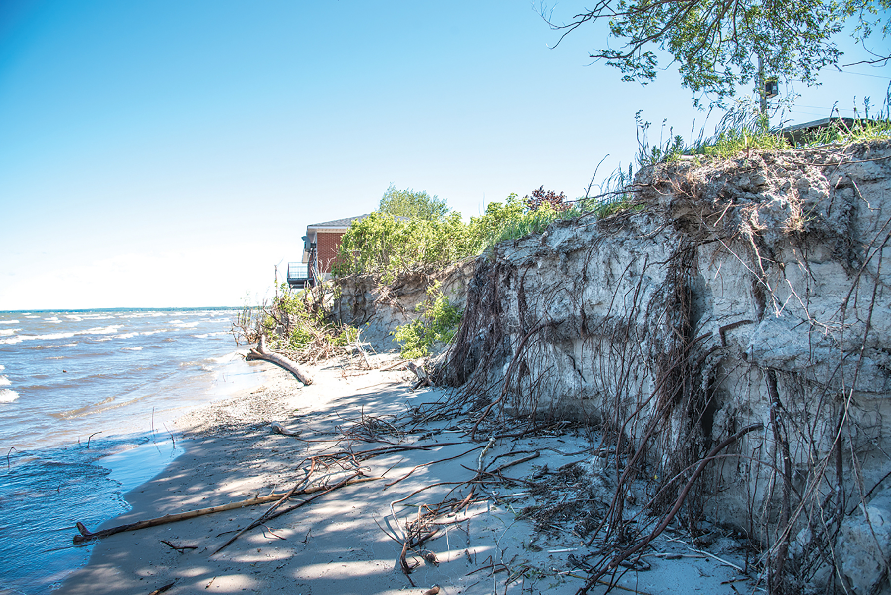
At the western end of Wasaga Beach, waterfront property owners are also seeing the beach disappear. The Wasaga West Beach Association has been working closely with Ontario Parks over the years to keep the beach a sandy recreational area, free of invasive vegetation.
“The high water level is creating new challenges for maintenance this season,” says association president Marsha Ramage. “Although it’s impacted our shoreline, we are fortunate to still have some beach left. We have seen massive erosion of our sand dunes, and most of the beach vegetation in flat areas has been removed by high water and wave action. Some homeowners have seen the water reach their property lines, and fences and deck structures have been damaged or completely demolished. We have asked members looking for help to protect their properties to contact the superintendent of our local Ontario Parks office or the Nottawasaga Valley Conservation Authority to apply for the proper permits.”
Ontario Parks is responsible for monitoring shorelines within provincial park boundaries, which includes most of the 14 kilometres of Wasaga Beach Provincial Park. “For several years, the lake levels on the Great Lakes have remained high affecting several kilometers of shoreline in many areas, including Wasaga Beach Provincial Park,” says John Fisher, Ontario Parks superintendent for Wasaga Beach.
“Due to continuing high water levels on Georgian Bay and severe storm events, the shoreline of Wasaga Beach Provincial Park has experienced significant erosion and flooding in recent years. High water levels have also resulted in less beach area.” According to Fisher, shoreline erosion remediation may require review and analysis from the Ministry of Natural Resources and Forests (MNRF) District, the local municipality, the conservation authority, federal jurisdictions (Department of Fisheries & Oceans), private consultants and environmental assessments with public consultation.
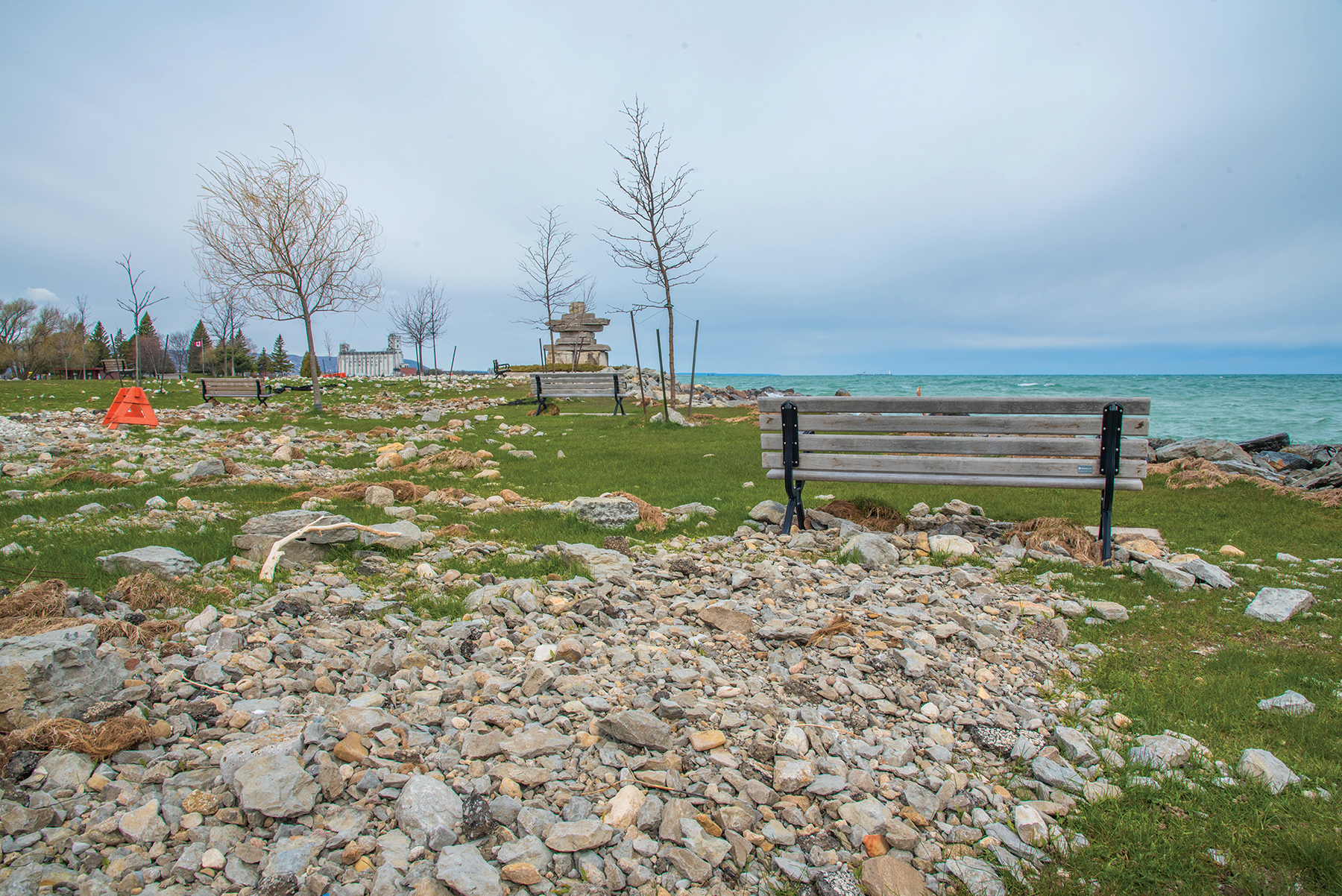
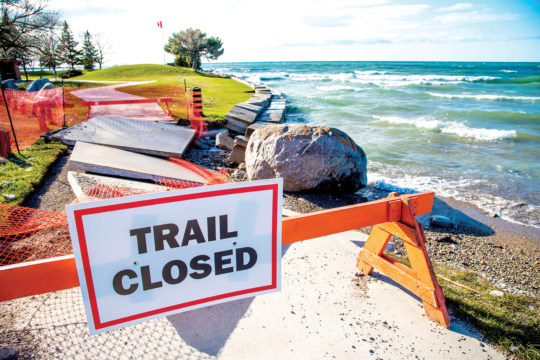
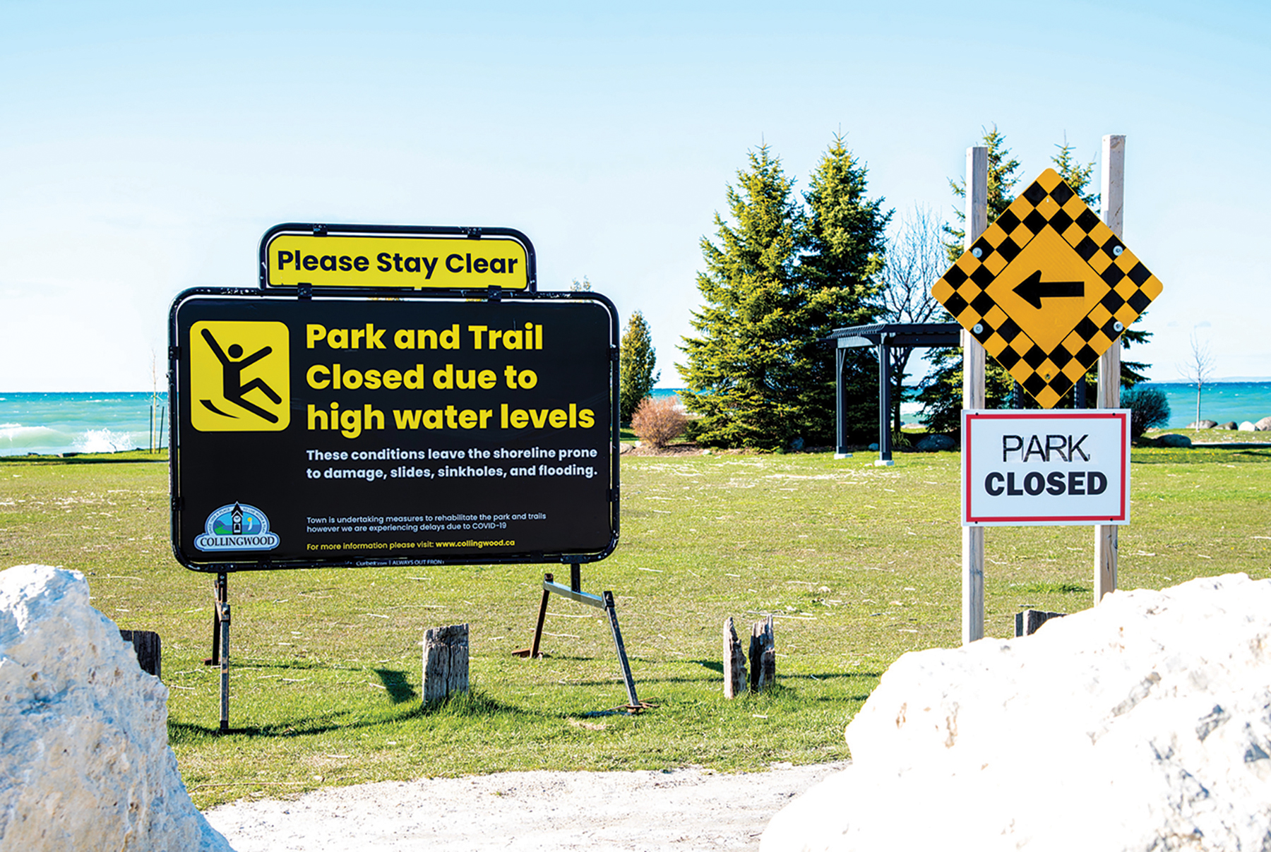
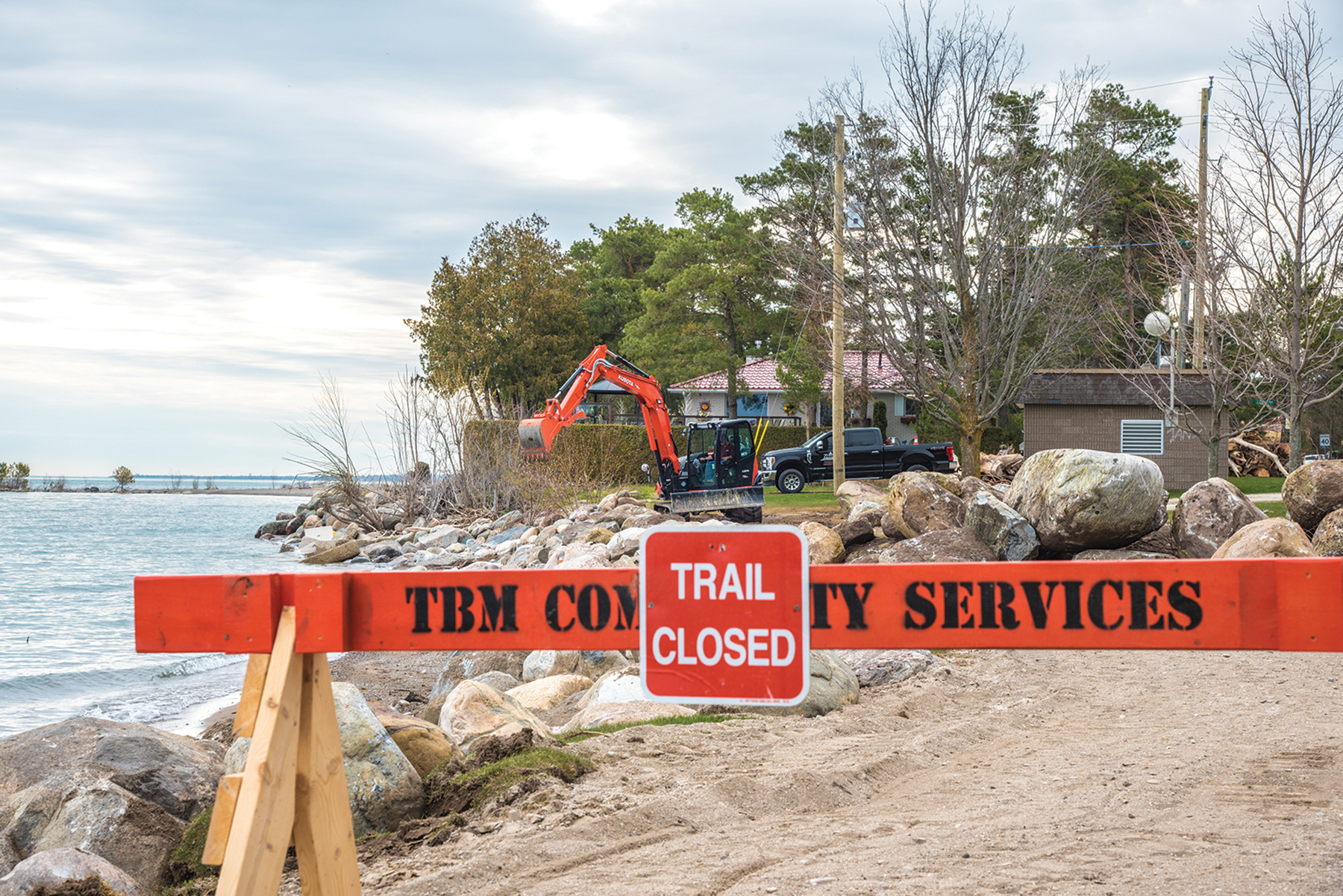
West of Wasaga Beach, the waterfront in the Town of Collingwood is also being impacted by the rising Georgian Bay waters. According to Dean Collver, director of parks and recreation, many municipal trails and parks are being eroded or risk disappearing altogether.
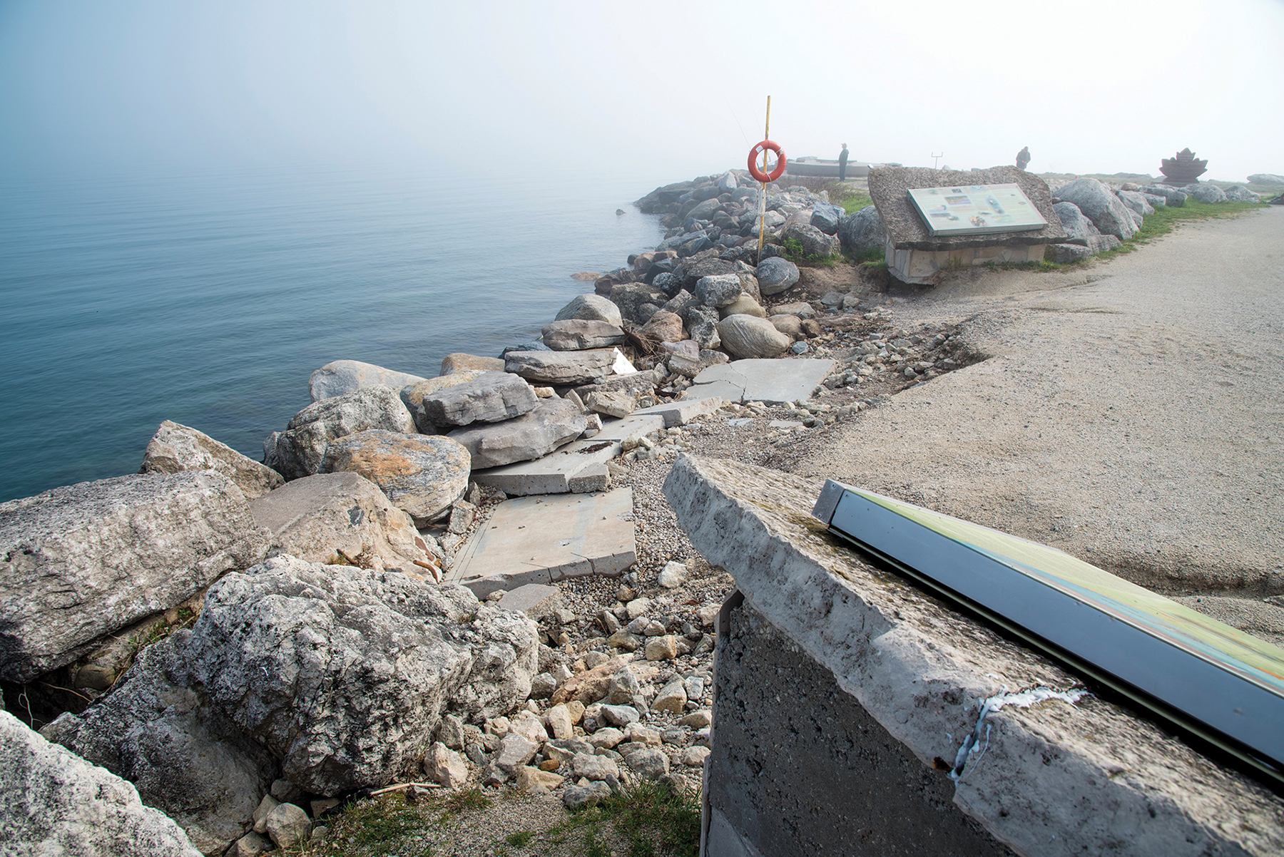
“We are proud of our 60 kilometres of trails, but they are at risk,” he says. “The trail to the northwest harbour is under two to three feet of water. We’re doing an engineering assessment to see if a boardwalk there would be feasible. The extreme west end of Sunset Park is eroded. The town has already spent $350,000 to restore the shoreline by replacing and building up stones, but more is needed for the long term. Council is considering more dollars to take other ‘soft treatment’ actions involving designing soil types and vegetation planting to establish a healthier shoreline.”
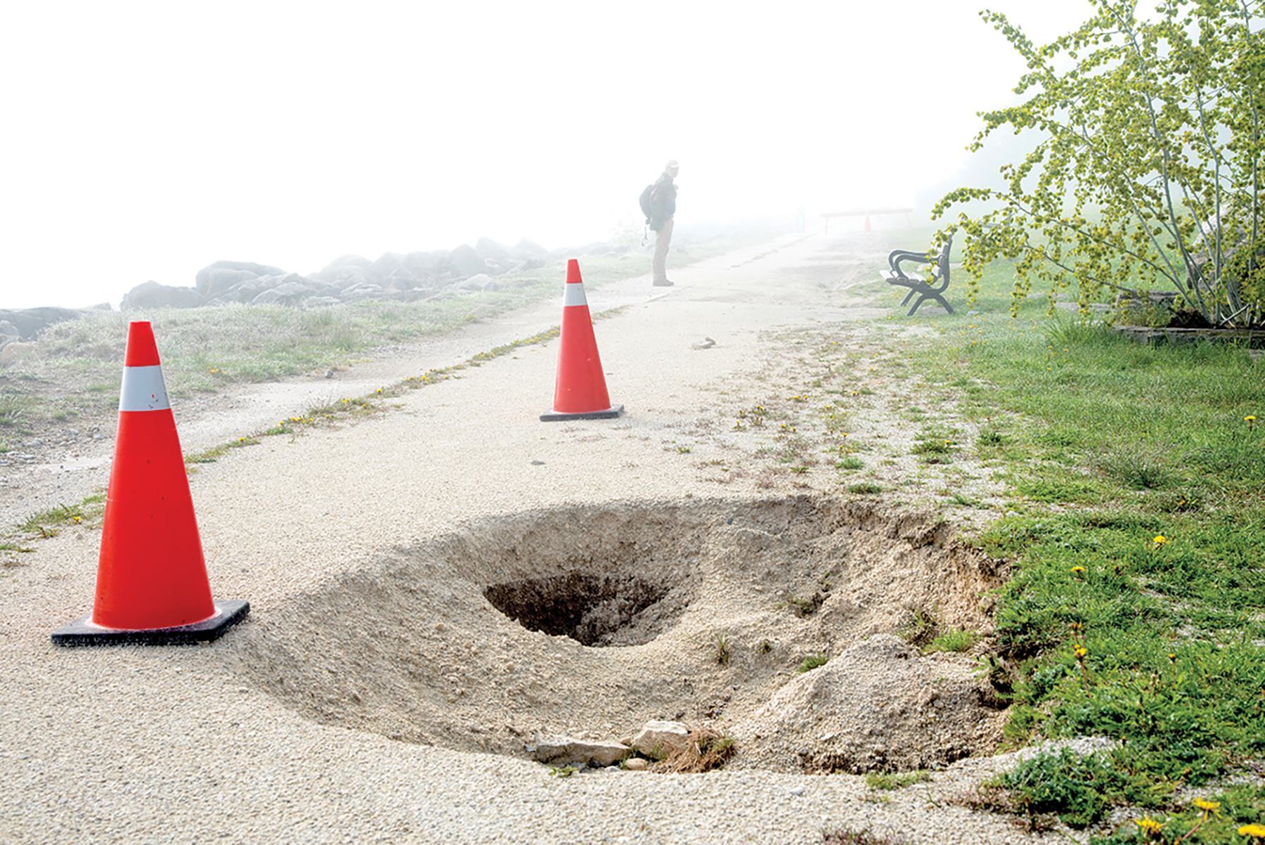
According to Collver, other high water problems require attention, such as shoring up at Harbourview Park to prevent erosion, replacing a jut that extends out into the west harbour, fixing sink holes in Millennium Park, and continually pumping out a section of Heritage Drive – “the size of a football field” – due to flooding. “What’s the long-term solution?” Collver muses. “It’ a toss-up between spending more money or waiting until the water recedes. For now, we have a priority plan in place to deal with water issues as they arise.”

Hayworth points to a neighbour’s home two doors away, noting that her deck was on their lawn. Another neighbour had a patio over the water that started to collapse.
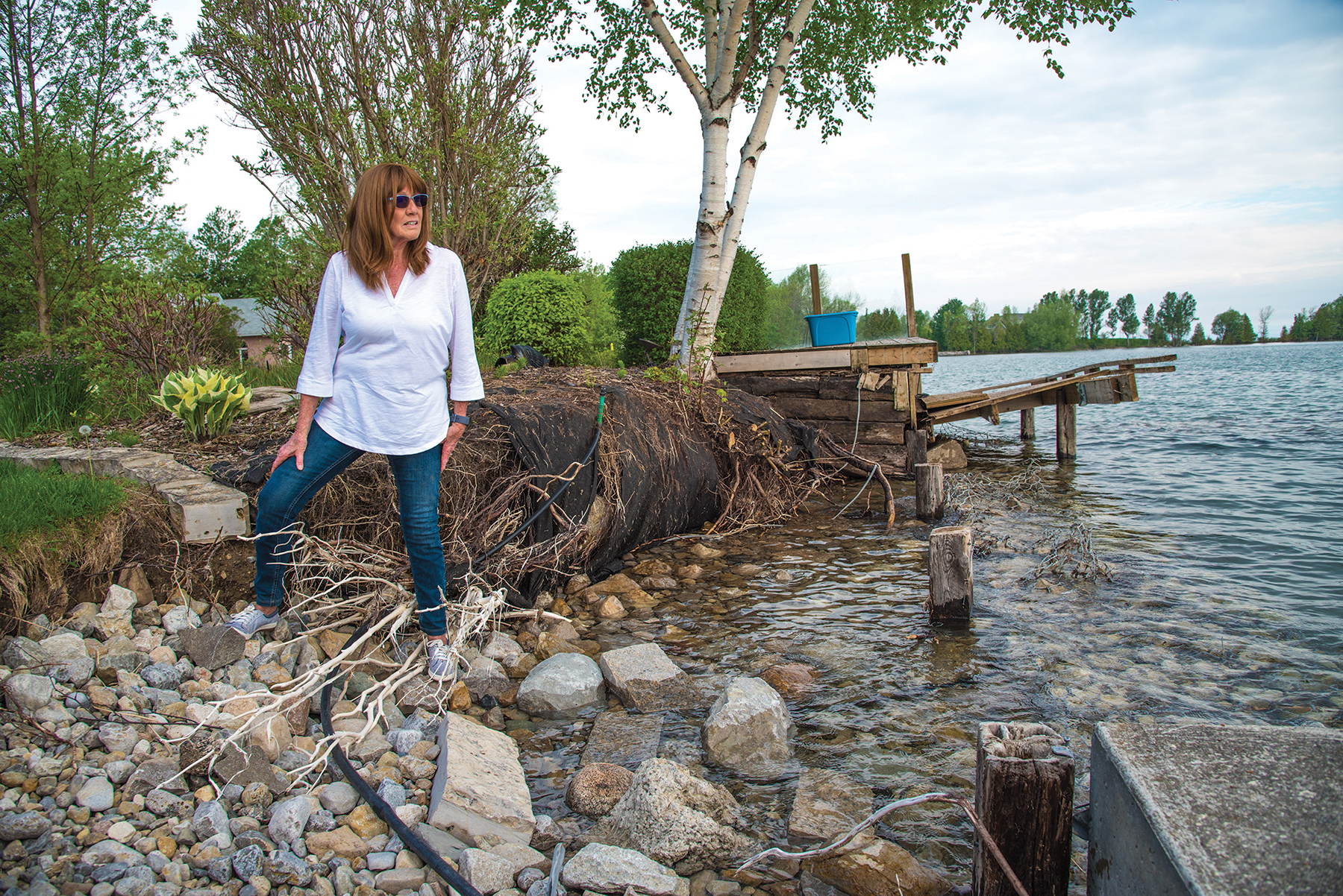
At the west end of Collingwood off Long Point Road, one waterfront resident is waging a personal battle against the forces of nature. “When we bought our house in 2014, the gardens were in bad shape, so we started over,” says Moira Hayworth. “But over the past few years, we’ve lost a ton of shoreline and our gardens have collapsed. It started with a storm last October, but every storm since then has taken out more and more. When we bought the property, we had a beach, a volleyball net and a fire pit. Now our beautiful birch tree is hanging by its toenails. Since 2015, every time we have gone away and come back, something else is gone.”
Hayworth points to a neighbour’s home two doors away, noting that her deck was on their lawn. Another neighbour had a patio over the water that started to collapse. “They’ve decided to install large square stones to reinforce their shoreline, which are brought in from Manitoulin Island,” she says.
“We have decided to do the same, and we’ll need three levels of stone. It’s going to be expensive.”
When asked how equipment and materials will be brought to her shoreline given the lack of access on either side of her home, Hayworth admits that she and her husband had asked their next-door neighbours to allow access through their property, offering to fully compensate them for any damage. They refused.
“Two doors down the other way, there’s a small cottage owned by a young couple. They have allowed access, but only to their shoreline,” says Hayworth. “To get to our shoreline, the contractor needs to build an underwater stone bridge to bring in the equipment and materials to our site. As part of our deal with the couple, we took care of cleaning up the sediment from their property and will clean up their rock wall for them. They just bought the property, and they get tons of sediment in the water. Two weeks ago, their kids were swimming in it and got covered in rashes. I feel for them.”
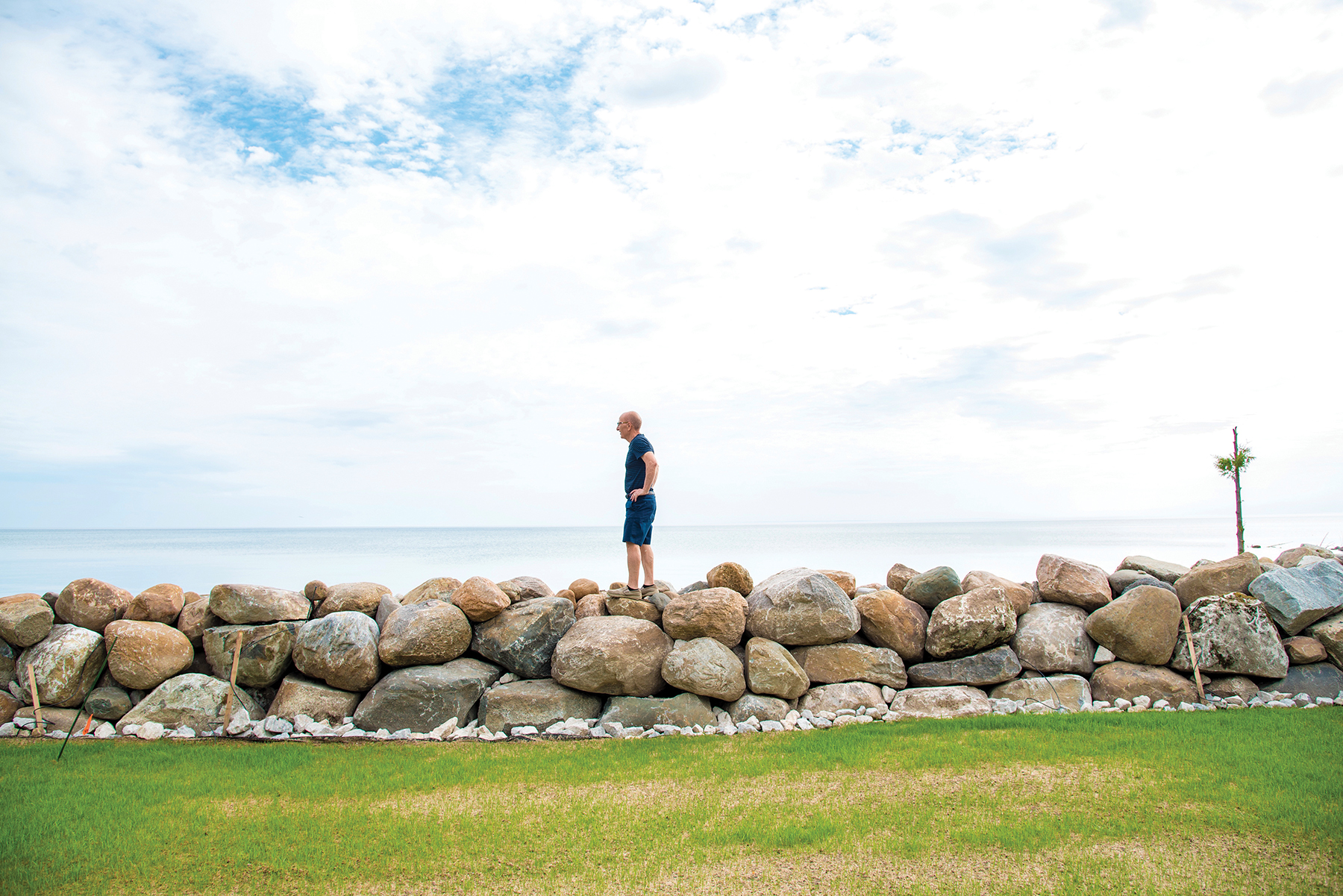
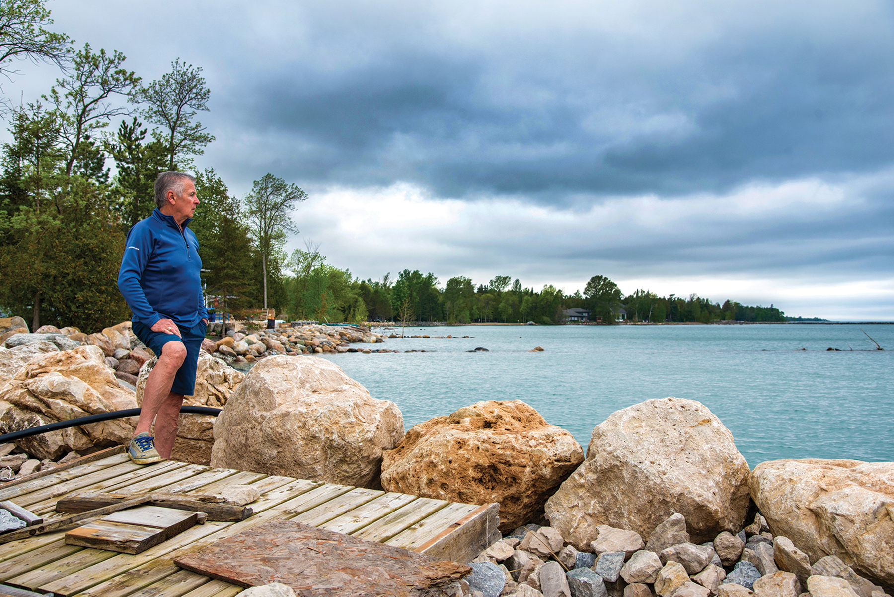
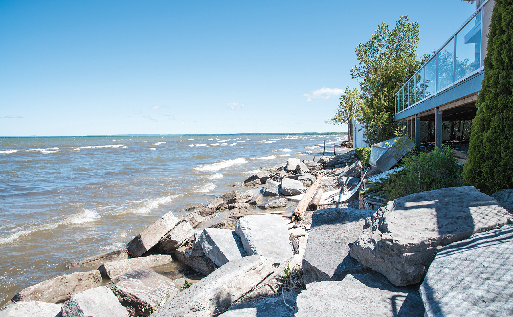
Seasonal resident Sal Vaccaro bought his waterfront home in The Blue Mountains 27 years ago. When his family moved in, their shoreline consisted of a gently sloping beach with some rocks that came up to where a retaining wall now stands. Today, the water just about reaches the wall. Vaccaro motions out to the Bay. “See the black rocks out there? It was built as a wave barrier that was about 600 feet long by 300 feet, sticking out of the water about six feet,” he says. “There’s not much left of it.”
Last November, Vaccaro had rocks placed on top of his retaining wall to build it up against the elements. “This past March, the day before we were leaving for a trip to Dubai, water and debris was splashing over this new wall and ended up making a mess of our grass and patio,” he recalls. “I was going crazy removing all the debris. So much for our wall! What I realized is that, with a rock wall, whatever splashes up and over it doesn’t go back into the water.”
Vaccaro believes the reason for the high water level in Georgian Bay is the reluctance of Great Lakes authorities to reduce lake levels by letting more water out of the St. Clair River, due to concerns about flooding in other areas. “Will the water go up or down?” he asks. “When the water went down a few years ago, we were all panicking and dredging. I think it’s a cycle, like anything – the stock market, real estate.”
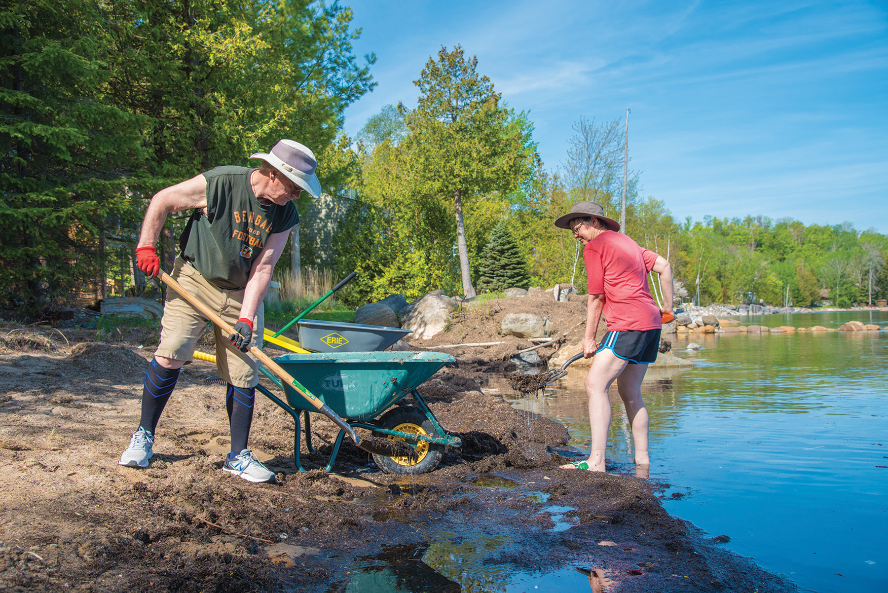
Like Vaccaro, Bruce Smith, whose family cottage sits on Lake Drive in Thornbury, is experiencing a constant barrage of debris washing up on his property. “My father built this cottage in 1951, and I’ve been coming up here since I was a boy,” he says. “We’ve never seen anything like this. All of this plant matter [moved and dispersed around the cottage] was on the beach – about 600 to 800 wheelbarrow-loads. We had a quote to remove it, which was quite high, with no guarantees that it won’t come back.”
Smith’s theory is that the debris is the result of soil erosion along the shores of the Bay, even from as far away as Wasaga Beach. “Due to wave action, it comes in, then goes out, then comes back in. My brother-in-law, who’s in the nursery business, told me that this stuff is really rich in nutrients.
The problem is that there’s a lot of bits of plastic in it. It’s only in the last five years or so that the plastic has been in there – pretty disgusting. Our beach gets buried in it, and you wouldn’t want to go in the water. I wish that people would realize that Georgian Bay is an amazing thing!”
Smith considers himself fortunate that the water was high in 1951, leading his dad to build the place a distance back from the shoreline. “And we’re also fortunate to still have a beach with the high winds and waves we’ve been getting. When I was a kid, you could walk all the way up and down the coast. We even had enough beach to play a bit of volleyball. Now, a lot of the cottagers around us have had to put in what looks like local rocks to save their shoreline, but some of them are using large, rectangular cut rock that comes from somewhere else.”
Smith’s take on the future: “Maybe this is as high as it’s going to get. Hopefully the worst is over. Until then, I keep chipping away at the sediment.”
In addition to waterfront property owners, local municipalities are facing challenges from the high water on their public lands. According to Meaford CAO Rob Armstrong, the shorelines at Memorial Park, Fred Raper Park, and a portion of David Johnson Park have needed to be protected and reinforced. In The Blue Mountains, stockpiled large stones have been used to shore up the most impacted beach in the municipality – Little River Beach – according to Director of Community Services Ryan Gibbons. Other beaches have shrunk considerably but, due to their “shelf shale” makeup, have experienced minimal shoreline erosion.
Why is the water so high? On July 17th, the International Joint Commission (IJC), which rules on applications for approval of projects affecting boundary (Canada/U.S.) or transboundary waters and approves conditions and criteria for regulating water levels and flows, held a public webinar on rising Great Lakes water levels. The event was held in partnership with the International Lake Ontario-St. Lawrence River Board, the International Lake Superior Board of Control and the Great Lakes-St. Lawrence River Adaptive Management Committee (GLAM).
The webinar presented the following facts:
- Precipitation in the Great Lakes from 2017 to 2019 was the highest three-year total in over 100 years, contributing to the highest water levels on record.
- The Great Lakes/St. Lawrence water system is interconnected. It is huge in terms of volume and basins.
- Seasonal factors impact lake water levels: snow accumulation in winter; snow melt, rainfall and increased runoff in the spring; more sunshine in the summer, which warms the waters; increased lake water evaporation in the fall.
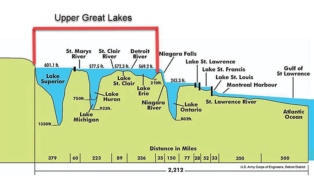
- The St. Marys River, which connects Lake Superior to Lakes Michigan and Huron/Georgian Bay, is the only water control point in the Great Lakes, affecting upstream and downstream water flow. Total St. Marys flows and lake levels are similar to what they would be without flow controls.
- Plan 2012 Balancing Principle allowed for adjustments to outflows to balance high or low levels upstream on Lake Superior with those downstream on Lake Michigan/Huron. If one lake is higher than the other, more or less water is released to balance the flows.
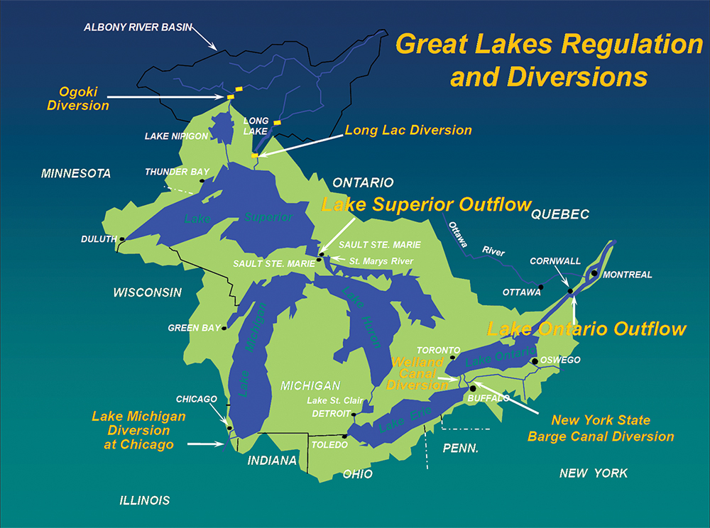
- There are three Great Lakes water diversion points: the Long Lac/Ogoki Diversion on the very north end of Lake Superior; the Chicago Diversion; and the Welland Diversion.
- When the high water in the Great Lakes will end is unknown. In the past, high levels have subsided with dry weather.
An earlier webinar in May, titled “Extreme Water Levels on the Upper Great Lakes: What Can Be Done?” was presented by Roger Gauthier, chair of Restore Our Water International (ROWI) and retired chief hydrologist with the U.S. Army Corps of Engineers in conjunction with the Georgian Bay Great Lakes Foundation (GBGLF), chaired by Mary Muter.

While Gauthier concurs that climate change plays a large role in lake water levels – causing less ice cover, more severe storm events and higher water temperatures – he also pointed to historic human interventions as a big part of the problem.
ROWI is a U.S./Canada non-profit, binational umbrella organization of several shoreline property owner associations, small business owners and concerned citizens. GBGLF is a group of shore property associations and environmental concerns around Georgian Bay.
Gauthier began by releasing the latest statistic on water levels in Lakes Michigan and Huron/Georgian Bay (considered as one lake as they are connected by the wide and deep Straits of Mackinac), which reported levels rising by a staggering 10 inches between May 2019 and May 2020, and predicted a rise of at least another five inches by the end of August 2020, setting new record highs this year.
While Gauthier concurs that climate change plays a large role in lake water levels – causing less ice cover, more severe storm events and higher water temperatures – he also pointed to historic human interventions as a big part of the problem.
As the webinar outlined, two human interventions were introduced more than 100 years ago that have impacted water levels over the years: the Long Lac/Ogoki Diversion north of Lake Superior, which creates more water outflow into Superior (then into Lakes Michigan and Huron/Georgian Bay); and the Chicago Diversion, designed to remove water from Lake Michigan as required.
The intent of both diversions was purely economic, with a priority to support hydroelectric power and water freight. Gauthier notes that 95 per cent of the Lake Superior outflow is controlled by hydropower plants on either side of the St. Marys River. The average outflow over the last 102 years is 76,000 cubic feet per second (cfs). In May 2020, the target outflow is 80,900 cfs, a 6.5 per cent increase above the long-term average.
The webinar cited another factor in the increase in Lake Michigan/Huron levels: the human manipulation of the St. Clair River, which has caused sand accumulation in the river over time, reducing the ability of the river to outflow.
Recommendations on the next steps needed to reduce lake levels are to decrease the Long Lac/Ogoki Diversion – easiest to do, with no capital costs, and could result in a 4.5 inch drop in Michigan/Huron lake levels in 12 to 24 months – and increasing the Chicago Diversion, which could lower Michigan/Huron water levels by an additional 2.5 inches.
The webinar’s two presenting organizations claim that historic modifications to the system can be reversed, likely with substantial and acceptable costs to prevent future water level extremes. However, they worry that the current mind-set is to react to one crisis after the next.
“Prudent, long-term planning and follow-through are needed. We should send a clear message to the International Joint Commission (IJC) to think and act ‘outside the box.’ We don’t need more studies, ineffective adaptive management approaches or excuses. We need them to follow through on published recommendations. Furthermore, we need an equal emphasis on the St. Clair – Detroit River system to monitor critical changes in this waterway.”
GBGLF chair Mary Muter adds, “The IJC is now holding Lake Superior to range. Although it’s reasonable to increase the water levels, we’re asking them to withhold this “The International Lake Superior Board of Control is continually discharging above what the 2012 Balancing Principle Plan allowed. We can find no justification for doing so. Although climate is a factor in high Huron/Georgian Bay water levels, government agencies are only blaming the climate and inaccurately over-recording St. Clair River outflows.”
Muter is currently working with Professor Pat Chow of Simon Fraser University, assessing the impact of high water levels on wetlands in Georgian Bay. “In many cases, water has been pushing into shoreline rock and woodland,” she says.
She and Chow are conducting water assessments, tracking young fish near shores. “It’s different now because there is very little shallow water vegetation where young fish feed, forcing them into deeper water where they are eaten by larger fish. The east and north coasts of Georgian Bay are particularly sensitive to water level fluctuations.”
While Gauthier and Muter believe that human intervention in the Great Lakes has been the primary factor in high water levels, David Sweetman of another concerned group, Georgian Bay Forever, acknowledges the human factor but places most of the blame squarely on the climate.
“Water in Georgian Bay goes in and out through connecting channels, precipitation and evaporation. Even subtle changes in rivers can result in an underestimation of evaporation changes,” he says. “It’s all driven by energy in the atmosphere. Since the 1980s, the increase in extra energies due to climate change has had a tremendous impact on the lake, with much flashier transitions between high and low water. What our grandparents predicted doesn’t apply anymore.”
Sweetman believes that we are now in a major transition stage. “Lots of things change in the Great Lakes ecosystems. These changes will continue with a one degree Celsius increase [in temperature]. Canada gets hit a lot harder because we’re a northern country with lots of water vapour. It’s like a heat pump. We’re headed for huge storms in the future.”
Sweetman observes that our Octobers are getting wetter, leading to a higher water level later in the year and more water in the spring. “Looking at long-term modelling from Environment Canada over the next 40 to 50 years, it appears that our water levels will continue to fluctuate, but slowly increase on average from year to year.”
His recommendation for Georgian Bay waterfront property owners and municipalities is simple: adapt. “Make sure that properties are redesigned and weatherproofed to accommodate rising water levels. For example, install floating versus permanent docks with reversable access ramps.”
Whether it is the result of human intervention, an effect of climate change, or a combination of both factors, Georgian Bay water levels are rising to record levels, and indications are that they will continue to do so in the foreseeable future. While correcting the human activity of the past may play a moderate role in controlling water levels, it appears that Mother Nature is winning the battle. For this reason, it is important for waterfront residents and municipalities to prepare for the future by reinforcing and redesigning their shorelines and vulnerable waterfront structures. ❧


